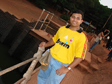
As its been with we CGI guys, we love small treks and treks in rains is far more fun. But this time around we planned a trek in hot October. Thanks to Indian government and Father of Nation “Gandhiji”, 2nd October we planned a trek to Koraigad. Learning from my previous experiences, I sent mails well in advance to all, and many decided to come. But as it turned out, we were only six of us on the day. Prasad Sawant(sniper - with his NIKON camera gun), Prasad (the dude) Shirsat , Jayakumar, Ankit(last trek before marriage), Amit and myself started our travel early in the morning.
Ankit coordinated with the vehicle and picked up all of us from respective spots. Me from Andheri, Prasad from Bandra, Prasad and Amit from Sion and Jaya from Vashi. This trek was going to be a bit different.
We finally manage to reach Lonavala at about 09:30 am. A quick breakfast on our way to Lonavla at the
To the Basepoint – Peth Shahapur
Ideally, had you been in a small group you’d prefer to take a Bus to the Peth-Shahapur village which is about 25kms from Lonavala town and start the trek from there. But then again you’d have to check for the bus timings and probably start a bit early from the town. The road connecting Lonavala town and Peth-Shahapur village and further down the
The walk uphill - Kille Koraigad
The Koraigad peak looks highly challenging when seen from the base. But believe me, even my four year niece would easily take on it! A path to the left from the base point takes you up to a small tableland and from there you just need to follow the path. If you’re fortunate enough, you could get to walk through streams that flow from the peak. About 20 minutes into the walk you’d be seeing steps up to the fort and from then on it’s just about running uphill. Even before you realize the distance you’ve covered, you’d be 3,000 Ft above MSL. There is one quite big cave and Ganapati temple midway. If well maintained it could easily accommodate fifty guys.
Once you reach the peak you realize how deceiving the fort looks from the base. I was expecting to see a small strip of land and nothing more than that. But there was a lot more in store - A vastly spread out table land with a couple of decently big fresh water ponds and thankfully, they were not even remotely spoilt! It is a big fort indeed. In its old golden years must have been pretty huge. Some remains of its past glory are still visible. The hilltop looked sunny yellow as the grass flowers covered the whole place.
Now a days major attraction of this place is nothing but the helicopter view of the
All the water that we had in our bags was over by this time and everyone was so thirsty…we had our small lunch, apple each, and approached one of the ponds on the top. A small halt there and we soon started our way down the hill and reached the base point in about thirty minutes.
Bhushi DamAs it has been a kind of tradition, we had a halt at Bunshi dam also. The crowd is usually thick here, but as it was off season, we could hardly spot a big gang. Some few were still interested to go into the waters and directly jumped into the dam. Brave but too dangerous. Ohh did I make a
Moments after the disappointing nimbu-pani shot, we decided to leave the place and get back to Lonavala We had our tummies full @Radha ![]() . Bought some chikki, fudge and sharbat from the famous Purohit’s and jumped into the car again. A beautiful location was spotted on our way back from where you get a panorama view of Kune fall and the konkan kada . taking some snaps was so irresistible. By 8.30 pm reached home pretty comfortably!
. Bought some chikki, fudge and sharbat from the famous Purohit’s and jumped into the car again. A beautiful location was spotted on our way back from where you get a panorama view of Kune fall and the konkan kada . taking some snaps was so irresistible. By 8.30 pm reached home pretty comfortably!
A sweet simple trek to enjoys nature’s bounty. Indeed a beautiful place to be!
Trek Info:
Route: Lonavala > Peth-Shapur Village >> Koraigad
Distance: Approx 30kms from lonavala town
Time : Uphill: 45mins| Downhill: 30minutes.
Transport: Preferably hire a cab
Best time to visit: Monsoon!
Endurance: low | Difficulty : low


